Characteristics
Use: Residential
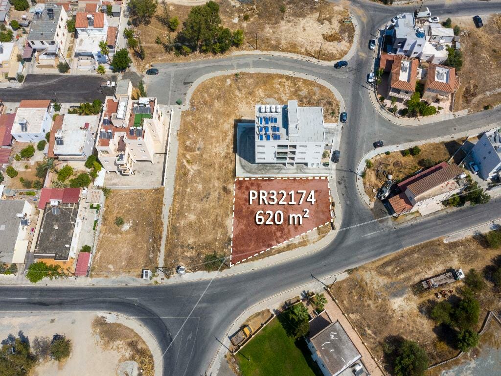
Land Area: 620 m2 (whole share)
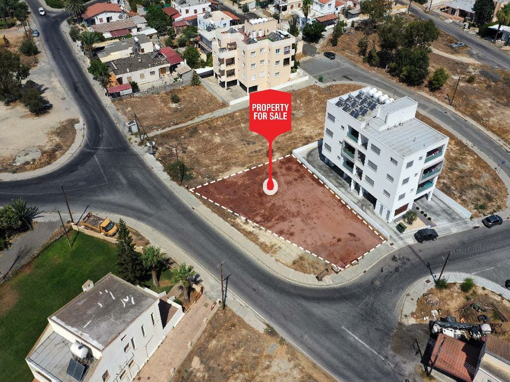
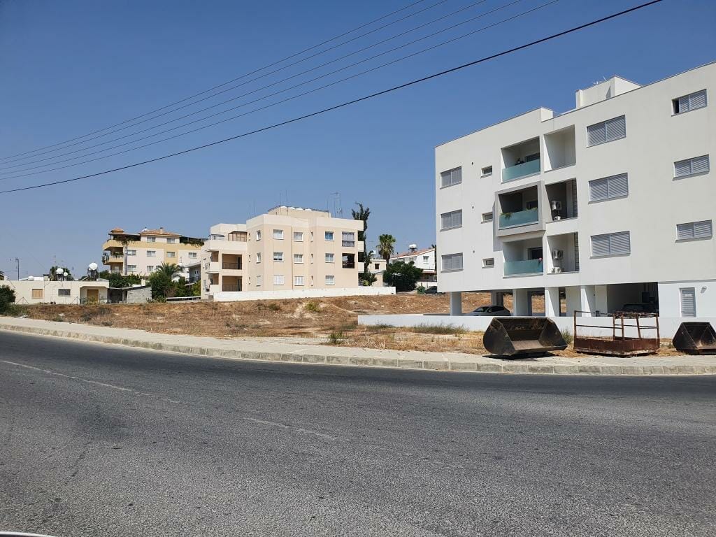
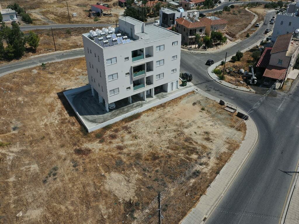
Property Description & Location
Residential corner plot in a central location in Geri Municipality in Nicosia District. It is situated at a distance of 200 meters (approx.) north of Geri Town Hall and 370 meters (approx.) southeast of Agiou Mina Church.
The property is situated close to all necessary amenities and services such as supermarkets, schools restaurants etc. In addition, it enjoys good access to the neighboring municipalities and the city of Nicosia. Furthermore, the University of Cyprus is also a short drive away.
The plot has a regular shape, a level land topography and a street frontage of 45 meters. The property falls within the residential zone Ka5 with building density of 100% and allows for the construction of a three-storey building.
The above price might be subject to VAT.
Residential plot in an attractive and attractive neighborhood in Egkomi Municipality of Nicosia District.
The property is ideal situated in an area that offers an abundance of amenities and services such as supermarkets, shops, cafes, schools etc. In addition, the property enjoys excellent access to the main city routes and motorway.
The
Residential field in Geri municipality of Nicosia district.
The property it is ideally situated close to a plethora of amenities and services such as schools, banks, supermarkets, shops etc. It is an excellent location which designates an increased demand for residential properties due to its attractiveness and accessibility.
It has a regular
Residential plot which forms the ½ western part of the parcel, in a quiet and beautiful neighborhood of Agios Dometios Municipality, Nicosia district.
The property is ideally located close to a variety of services and amenities, such as schools, banks, supermarkets, shops, etc. In addition, it has excellent access to the
Residential plot in a quiet location in Pano Deftera community of Nicosia District.
It is situated in a quiet and beautiful area close to all necessary amenities and services and it has easy access to the neighboring villages/ municipalities.
It has a trapeze shape, level land surface and abuts onto a registered